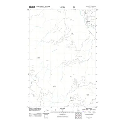
2011 Map of Fernwood
USGS Topo · Published 2011About this map
The Saint Maries River flows through the northeastern corner of this terrain, providing the primary drainage for a landscape defined by significant peaks and timbered ridges. The settlement of Fernwood serves as the local hub near the river's confluence with Finn Creek and Crystal Creek, while the smaller community of West Emerald is situated further south. This area is characterized by numerous named heights, including Green Mountain, Willow Peak, and Emerald Butte, which overlook a complex network of drainages such as Carpenter Creek and Willow Creek.
Find a feature on this map
28 named features on this map. Tap any name to fly to it.
Don’t see what you’re looking for? This feature index may not catch every label — zoom into the map to look around manually.
Map Details
Editions of this 2011 Fernwood Map
This is the sole edition of this map. No revisions or reprints were ever made.
Other maps of this area

1955 · Pullman
USGS Topo · 1:250,000

1955 · Spokane
USGS Topo · 1:250,000

1957 · Emida
USGS Topo · 1:62,500

1958 · Spokane
USGS Topo · 1:250,000

1958 · Pullman
USGS Topo · 1:250,000

1961 · Deary
USGS Topo · 1:62,500

1961 · Fernwood
USGS Topo · 1:62,500

1961 · Bovill
USGS Topo · 1:62,500

1981 · St Maries
USGS Topo · 1:100,000

1981 · Potlatch
USGS Topo · 1:100,000