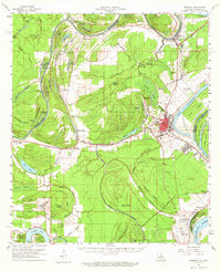
1961 Map of Ferriday
USGS Topo · Published 1965About this map
Ferriday serves as the focal point of this 1961 topographical study, situated at the junction of the Missouri Pacific railroad lines and several state highways. The landscape is defined by the complex hydrology of the Mississippi Delta, where the Tensas River and numerous oxbow lakes like Long Lake and Bee Lake illustrate the shifting river channels of Concordia Parish. This era captures the region's mid-century economic mix, from the concentrated oil activity in the Horseshoe Oil Field to the rural centers of Clayton and Frogmore.
Find a feature on this map
121 named features on this map. Tap any name to fly to it.
Don’t see what you’re looking for? This feature index may not catch every label — zoom into the map to look around manually.
Map Details
Editions of this 1961 Ferriday Map
2 editions found
Other maps of this area

1909 · Sycamore Landing
USGS Topo · 1:24,000

1909 · Vidalia
USGS Topo · 1:24,000

1921 · Natchez
USGS Topo · 1:48,000

1922 · Natchez
USGS Topo · 1:62,500

1935 · Tooleys
USGS Topo · 1:62,500

1939 · Red Gum
USGS Topo · 1:62,500

1939 · Natchez
USGS Topo · 1:62,500

1939 · Kingston
USGS Topo · 1:62,500

1939 · Deer Park
USGS Topo · 1:62,500

1939 · Locust Ridge
USGS Topo · 1:62,500