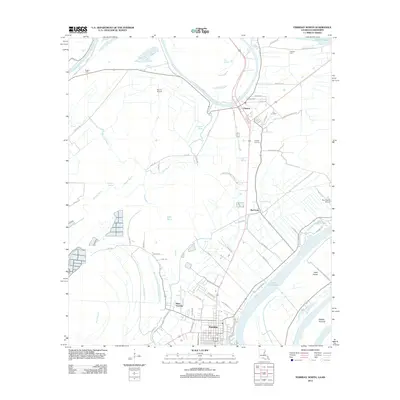
2012 Map of Ferriday North
USGS Topo · Published 2012About this map
The Tensas River meanders through the alluvial landscape of Concordia Parish, defining the northern geography above the growing hub of Ferriday. This early 21st-century survey documents a region defined by its relationship to water and agriculture, where large lakes like Lake Concordia and Carroll Lake sit alongside smaller bayous such as Opossum Bayou and Kimball Bayou. The settlement pattern follows the higher ground and road networks, with established communities like Clayton and West Ferriday serving as anchors. Local genealogy and land use are evidenced by family-named sites like Calhoun Cem and Rogers Cem, while the presence of Dunns Airport and Summerell Airport reflects the ongoing importance of crop dusting and local aviation in this delta environment. The map also highlights distinctive landforms within the river system, including Vidal Island and Middle Ground.
Find a feature on this map
59 named features on this map. Tap any name to fly to it.
Don’t see what you’re looking for? This feature index may not catch every label — zoom into the map to look around manually.
Map Details
Editions of this 2012 Ferriday North Map
This is the sole edition of this map. No revisions or reprints were ever made.
Other maps of this area

1909 · Sycamore Landing
USGS Topo · 1:24,000

1909 · Vidalia
USGS Topo · 1:24,000

1921 · Natchez
USGS Topo · 1:48,000

1922 · Natchez
USGS Topo · 1:62,500

1939 · Red Gum
USGS Topo · 1:62,500

1939 · Natchez
USGS Topo · 1:62,500

1939 · Locust Ridge
USGS Topo · 1:62,500

1941 · Sicily Island
USGS Topo · 1:62,500

1953 · Natchez
USGS Topo · 1:250,000

1956 · Natchez
USGS Topo · 1:250,000