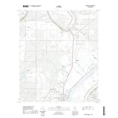
2020 Map of Ferriday North
USGS Topo · Published 2020About this map
Ferriday and its neighboring settlements define this low-lying region along the border of Louisiana and Mississippi. The landscape is shaped by the wandering path of the Tensas River and a series of backwater lakes and bayous, including Lake Concordia, Jenkins Lake, and the expansive Panola Brake. This modern survey reveals a complex network of parish roads and levees, such as Dunbarton Levee Rd, designed to manage the hydrology of the Mississippi floodplain. Genealogists and local historians can locate established landmarks like Rogers Cem and Calhoun Cem, which reflect the long-standing agricultural communities here. To the east, the map traces the shifting riverine geography at Vidal Island and Marengo Bend, where the Louisiana Mississippi state line follows the natural curves of the water. The settlement patterns at Clayton and Red Gum further illustrate the transition from swampy wetlands to settled residential and transit corridors.
Find a feature on this map
81 named features on this map. Tap any name to fly to it.
Don’t see what you’re looking for? This feature index may not catch every label — zoom into the map to look around manually.
Map Details
Editions of this 2020 Ferriday North Map
This is the sole edition of this map. No revisions or reprints were ever made.
Other maps of this area

1909 · Sycamore Landing
USGS Topo · 1:24,000

1909 · Vidalia
USGS Topo · 1:24,000

1921 · Natchez
USGS Topo · 1:48,000

1922 · Natchez
USGS Topo · 1:62,500

1939 · Red Gum
USGS Topo · 1:62,500

1939 · Natchez
USGS Topo · 1:62,500

1939 · Locust Ridge
USGS Topo · 1:62,500

1941 · Sicily Island
USGS Topo · 1:62,500

1953 · Natchez
USGS Topo · 1:250,000

1956 · Natchez
USGS Topo · 1:250,000