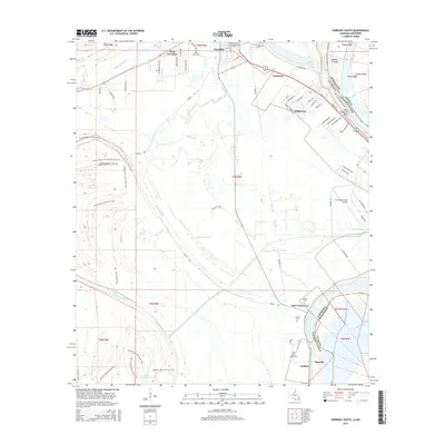
2015 Map of Ferriday South
USGS Topo · Published 2015About this map
Mississippi River oxbows and bottomland sloughs dominate this portion of Concordia Parish, where the winding Saint Catherine Bend and Natchez Island define the state border. Small communities like Ridgecrest, Sycamore, and Morville are scattered across the alluvial plain, linked by a network of local roads and recreational paths such as the Route 15 Trail. The landscape is a complex hydrologic network of backwaters, including Bayou Cocodrie and Little Wallace Lake, interspersed with managed lands featuring the Brooks Brake Unit ATV Trail and Old Growth Trail. Local family and community history is anchored by several small burial sites, including Lambert Cem and Sawyer Cem, located near the southern settlements. The presence of the Concordia Parish Airport and residential developments in West Ferriday and Sycamore illustrate the modern utility of this riverfront region in the mid-2010s.
Find a feature on this map
67 named features on this map. Tap any name to fly to it.
Don’t see what you’re looking for? This feature index may not catch every label — zoom into the map to look around manually.
Map Details
Editions of this 2015 Ferriday South Map
This is the sole edition of this map. No revisions or reprints were ever made.
Other maps of this area

1909 · Sycamore Landing
USGS Topo · 1:24,000

1909 · Vidalia
USGS Topo · 1:24,000

1921 · Natchez
USGS Topo · 1:48,000

1922 · Natchez
USGS Topo · 1:62,500

1939 · Red Gum
USGS Topo · 1:62,500

1939 · Natchez
USGS Topo · 1:62,500

1939 · Kingston
USGS Topo · 1:62,500

1939 · Deer Park
USGS Topo · 1:62,500

1953 · Natchez
USGS Topo · 1:250,000

1956 · Natchez
USGS Topo · 1:250,000