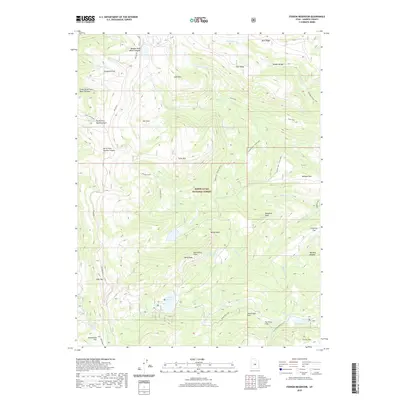
2020 Map of Ferron Reservoir
USGS Topo · Published 2020About this map
The high-elevation ridge of the Wasatch Plateau dominates this landscape within the Manti-La Sal National Forest. Traversing the western edge of the quadrangle, the famous Skyline Dr provides access to the crest, connecting numerous drainages like Twelvemile Cr and Hougaard Fork. The area is characterized by dramatic topographic features such as The White Slides and high peaks including Petty Peak and Ferron Mtn.
Find a feature on this map
51 named features on this map. Tap any name to fly to it.
Don’t see what you’re looking for? This feature index may not catch every label — zoom into the map to look around manually.
Map Details
Editions of this 2020 Ferron Reservoir Map
This is the sole edition of this map. No revisions or reprints were ever made.
Other maps of this area

1885 · Manti
USGS Topo · 1:250,000

1895 · Manti
USGS Topo · 1:250,000

1922 · Wasatch
USGS Topo · 1:31,680

1956 · Price
USGS Topo · 1:250,000

1960 · Price
USGS Topo · 1:250,000

1962 · Price
USGS Topo · 1:250,000
1965 · Woods Lake
USGS Topo · 1:24,000

1965 · Black Mountain
USGS Topo · 1:24,000
1966 · Ferron Reservoir
USGS Topo · 1:24,000
1966 · Heliotrope Mtn
USGS Topo · 1:24,000