
1972 Map of Fertile NE
USGS Topo · Published 1975About this map
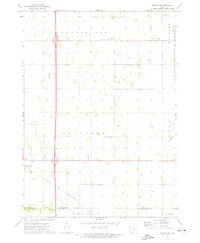
Shell Rock River winds through the northeastern corner of this Worth County landscape, defining a rural Iowa environment focused on water management and conservation in the early 1970s. The map illustrates a complex network of man-made drainage, including Ditch No 2 and Ditch No 40, which transformed the natural wetlands of Hartland and Brookfield into productive agricultural land. Conservation efforts are highly visible through the extensive Elk Creek Marsh State Game Management Area and several local recreation sites like Ochee Yahola County Park. Local history is anchored by the North Shell Rock Cem and scattered Gravel Pits that supported the local road infrastructure. This 1972 survey also captures the early presence of modern transit amenities, specifically the Rest Area situated along the major highway corridor bisecting the region.
Find a feature on this map
20 named features on this map. Tap any name to fly to it.
Don’t see what you’re looking for? This feature index may not catch every label — zoom into the map to look around manually.
Map Details
Editions of this 1972 Fertile NE Map
This is the sole edition of this map. No revisions or reprints were ever made.
Other maps of this area

1954 · Albert Lea
USGS Topo · 1:62,500

1954 · Hayward
USGS Topo · 1:62,500

1954 · Mason City
USGS Topo · 1:250,000

1957 · Mason City
USGS Topo · 1:250,000

1958 · Mason City
USGS Topo · 1:250,000

1972 · Manly
USGS Topo · 1:24,000

1972 · Fertile
USGS Topo · 1:24,000

1972 · Northwood
USGS Topo · 1:24,000

1972 · Bristol
USGS Topo · 1:24,000
1972 · Fertile SE
USGS Topo · 1:24,000