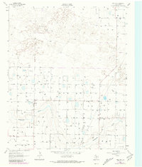
1962 Map of Fieldton
USGS Topo · Published 1981About this map
Fieldton and Hart Camp anchor this 1962 landscape in Lamb County, where the agricultural and industrial character of the Texas Panhandle is clearly defined by an extensive grid of irrigation and resource extraction. The area is dominated by the meandering course of Blackwater Draw, which cuts through the terrain, influencing the placement of early roads and small settlements. The map's high-density of water infrastructure, marked by numerous sites like Well 3583 and Well 3572, illustrates the transition to intensive groundwater-based farming in the mid-20th century.
Find a feature on this map
79 named features on this map. Tap any name to fly to it.
Don’t see what you’re looking for? This feature index may not catch every label — zoom into the map to look around manually.
Map Details
Editions of this 1962 Fieldton Map
2 editions found
Other maps of this area

1954 · Clovis
USGS Topo · 1:250,000

1954 · Brownfield
USGS Topo · 1:250,000

1957 · Anton
USGS Topo · 1:62,500

1958 · Brownfield
USGS Topo · 1:250,000

1958 · Clovis
USGS Topo · 1:250,000

1962 · Brownfield
USGS Topo · 1:250,000

1962 · Cofferville
USGS Topo · 1:24,000

1962 · Springlake
USGS Topo · 1:24,000

1962 · Fieldton
USGS Topo · 1:24,000

1963 · Olton
USGS Topo · 1:24,000