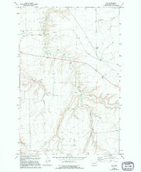
1965 Map of Fife
USGS Topo · Published 1994About this map
Box Elder Creek and its various tributaries carve a series of deep coulees through this section of Cascade County, defining a landscape of high plateaus and drainage basins. During the mid-1960s, this area north of Great Falls remained largely characterized by livestock operations and scattered extractive industry, as evidenced by multiple Corral sites and several Mines and Gravel Pit locations. The tiny settlements of Fife and Rogers serve as the primary human focal points in an otherwise sparsely populated ranching territory.
Find a feature on this map
12 named features on this map. Tap any name to fly to it.
Don’t see what you’re looking for? This feature index may not catch every label — zoom into the map to look around manually.
Map Details
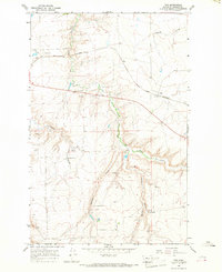
Editions of this 1965 Fife Map
2 editions found
Other maps of this area

1886 · Great Falls
USGS Topo · 1:250,000

1890 · Fort Benton
USGS Topo · 1:250,000

1892 · Fort Benton
USGS Topo · 1:250,000

1897 · Fort Benton
USGS Topo · 1:250,000

1948 · Portage
USGS Topo · 1:62,500

1949 · Portage
USGS Topo · 1:62,500

1954 · Great Falls
USGS Topo · 1:250,000

1954 · Waltham
USGS Topo · 1:24,000

1955 · Stockett
USGS Topo · 1:62,500

1956 · Highwood
USGS Topo · 1:62,500