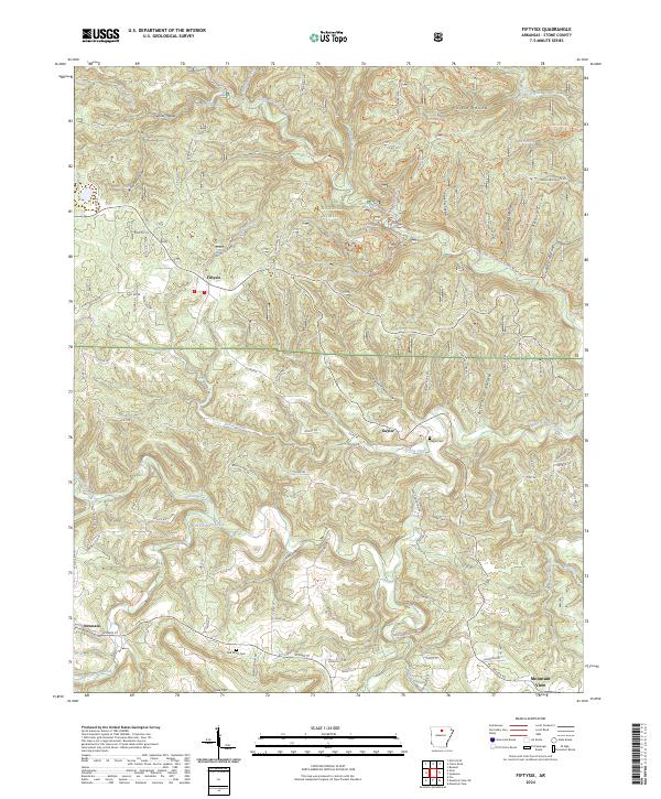
2024 Map of Fiftysix
USGS Topo · Published 2024About this map
The Ozark National Forest dominates this section of Stone County, where the topography is defined by a dense network of hollows and ridges. The protected waters of the North Sylamore Creek-Wild and Scenic River carve through the center of the sheet, supported by tributaries like Roasting Ear Creek and Lick Fork. Settlement patterns are concentrated along the winding ridge roads and valley floors, with the community of Fiftysix situated in the western portion and Gayler to the east. For those researching local families, the presence of the Gayler Cem and Red Doors Cem provides specific points of interest. The landscape is also shaped by numerous named hollows, such as Herald Hollow and Petrie Cave Hollow, reflecting the traditional nomenclature of the Ozark interior. Near the southern border, the terrain rises toward Cow Mtn, overlooking the edge of Mountain View.
Find a feature on this map
96 named features on this map. Tap any name to fly to it.
Don’t see what you’re looking for? This feature index may not catch every label — zoom into the map to look around manually.
Map Details
Editions of this 2024 Fiftysix Map
This is the sole edition of this map. No revisions or reprints were ever made.
Other maps of this area

1890 · Mountain Home
USGS Topo · 1:125,000

1891 · Mountain Home
USGS Topo · 1:125,000

1892 · Mountain View
USGS Topo · 1:125,000

1894 · Mountain View
USGS Topo · 1:125,000

1894 · Mountain Home
USGS Topo · 1:125,000

1945 · Harrison
USGS Topo · 1:250,000

1949 · Harrison
USGS Topo · 1:250,000

1954 · Harrison
USGS Topo · 1:250,000

1956 · Russellville
USGS Topo · 1:250,000

1958 · Harrison
USGS Topo · 1:250,000