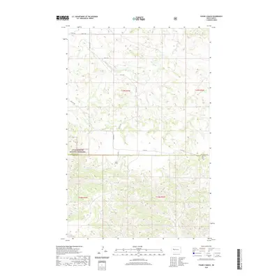
2020 Map of Figure 4 Ranch
USGS Topo · Published 2020About this map
Figure 4 Ranch sits at the heart of this Badlands landscape, where the high prairie of the Little Missouri National Grassland is deeply incised by the drainage networks of Bear Den Cr and Deep Cr. This topographic study reveals the sparse but vital infrastructure of the northern plains, spanning the boundary between McKenzie and Dunn counties. The section lines of the Public Land Survey System dictate the movement of local traffic, with routes like 24th St NW and 21st St NW following precise rectangular grids across the broken terrain. A network of rural arteries, including Bear Den Rd and Co Rte 53, connect the isolated ranching operations to the wider region. The map provides a look at the modern land use of the Missouri Plateau, where federal grassland management and private ranching interests coexist among the coulees and draws.
Find a feature on this map
16 named features on this map. Tap any name to fly to it.
Don’t see what you’re looking for? This feature index may not catch every label — zoom into the map to look around manually.
Map Details
Editions of this 2020 Figure 4 Ranch Map
This is the sole edition of this map. No revisions or reprints were ever made.
Other maps of this area

1953 · Watford City
USGS Topo · 1:250,000

1957 · Watford City
USGS Topo · 1:250,000

1958 · North Killdeer Mountain
USGS Topo · 1:24,000

1959 · Croff
USGS Topo · 1:24,000

1965 · Johnsons Corner
USGS Topo · 1:24,000

1965 · Blue Buttes SE
USGS Topo · 1:24,000

1967 · Watford City
USGS Topo · 1:250,000

1967 · Sanish SW
USGS Topo · 1:24,000

1970 · Mandaree
USGS Topo · 1:24,000

1970 · Lost Bridge
USGS Topo · 1:24,000