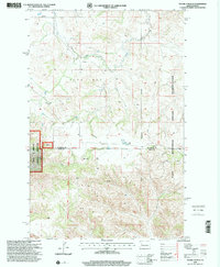
1997 Map of Figure 4 Ranch
USGS Topo · Published 2001About this map
Figure 4 Ranch sits at the heart of this North Dakota landscape, situated just south of the Twelfth Standard Parallel North in a region defined by dramatic breaks and drainages. The topography is shaped by the complex network of Bear Den Creek and Little Deep Creek, which carve through the land before reaching the nearby Missouri River breaks. This 1997 revision, based on 1960s topography and 1990s imagery, shows the boundary lines where the Little Missouri National Grassland meets private ranch holdings and the Fort Berthold Indian Reservation.
Find a feature on this map
13 named features on this map. Tap any name to fly to it.
Don’t see what you’re looking for? This feature index may not catch every label — zoom into the map to look around manually.
Map Details
Editions of this 1997 Figure 4 Ranch Map
This is the sole edition of this map. No revisions or reprints were ever made.
Other maps of this area

1953 · Watford City
USGS Topo · 1:250,000

1957 · Watford City
USGS Topo · 1:250,000

1958 · North Killdeer Mountain
USGS Topo · 1:24,000

1959 · Croff
USGS Topo · 1:24,000

1965 · Johnsons Corner
USGS Topo · 1:24,000

1965 · Blue Buttes SE
USGS Topo · 1:24,000

1967 · Watford City
USGS Topo · 1:250,000

1967 · Sanish SW
USGS Topo · 1:24,000

1970 · Mandaree
USGS Topo · 1:24,000

1970 · Lost Bridge
USGS Topo · 1:24,000