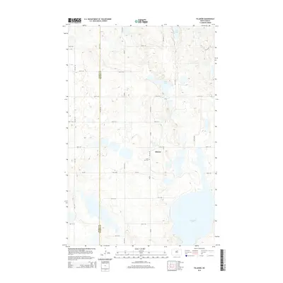
2014 Map of Fillmore
USGS Topo · Published 2014About this map
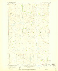
Fillmore stands as a quiet focal point on the central North Dakota prairie, situated along the border of Pierce Co and Benson Co. The landscape is defined by the prairie pothole region's characteristic wetlands and water bodies, including the expansive Cranberry Lake in the southeast and the smaller Sand Lake and Long Lake to the north. These glacial depressions create a complex hydrology that dictates the placement of the local road grid, which follows section lines wherever the terrain permits. Local history is anchored by the Saint Anns Cem, located just west of the town site. This 2014 survey documents a rural landscape where the placement of small settlements and cemeteries reflects the early twentieth-century settlement patterns of these high plains counties, even as modern infrastructure like CR-0305 and CR-0314 now serves the agricultural community.
Find a feature on this map
24 named features on this map. Tap any name to fly to it.
Don’t see what you’re looking for? This feature index may not catch every label — zoom into the map to look around manually.
Map Details
Editions of this 2014 Fillmore Map
This is the sole edition of this map. No revisions or reprints were ever made.
Other maps of this area

1953 · Devils Lake
USGS Topo · 1:250,000

1955 · Rugby
USGS Topo · 1:24,000

1956 · Devils Lake
USGS Topo · 1:250,000

1958 · Fillmore
USGS Topo · 1:24,000
1958 · Silva
USGS Topo · 1:24,000

1958 · Baker
USGS Topo · 1:24,000
1958 · Esmond
USGS Topo · 1:24,000
1958 · Petrified Lake
USGS Topo · 1:24,000
1958 · Harlow SW
USGS Topo · 1:24,000

1971 · Knox
USGS Topo · 1:24,000