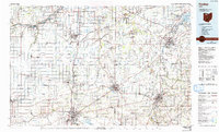
1986 Map of Findlay
USGS Topo · Published 1992About this map
The Blanchard River and Portage River drainage basins anchor this mid-1980s look at Northwest Ohio, where the grid of rural section lines meets concentrated industrial and educational hubs. The cities of Findlay, Fostoria, Tiffin, and Bowling Green serve as the primary anchors, with the latter featuring the sprawling campus of Bowling Green State University. Significant transit corridors are documented through active lines of the Conrail, Baltimore & Ohio RR, and Norfolk & Western RR, which converge in rail centers like Fostoria.
Find a feature on this map
159 named features on this map. Tap any name to fly to it.
Don’t see what you’re looking for? This feature index may not catch every label — zoom into the map to look around manually.
Map Details
Editions of this 1986 Findlay Map
2 editions found
Other maps of this area

1900 · Maumee Bay
USGS Topo · 1:62,500

1900 · Toledo
USGS Topo · 1:62,500

1900 · Oak Harbor
USGS Topo · 1:62,500

1901 · Put-In-Bay
USGS Topo · 1:62,500

1901 · Bellevue
USGS Topo · 1:62,500

1901 · Fostoria
USGS Topo · 1:62,500

1901 · Bowling Green
USGS Topo · 1:62,500

1901 · Fremont
USGS Topo · 1:62,500

1901 · Elmore
USGS Topo · 1:62,500

1903 · Bellevue
USGS Topo · 1:62,500