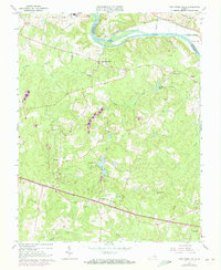
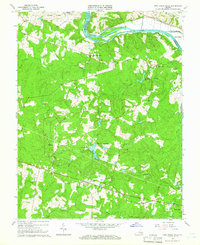
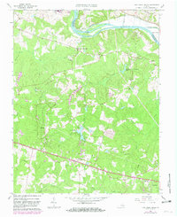
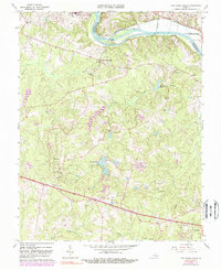
1964 Map of Fine Creek Mills
USGS Topo · Published 1973About this map
The James River and the Chesapeake and Ohio railroad trace the northern border of this Powhatan County landscape, where the colonial-era village of Fine Creek Mills sits near the confluence of Fine Creek and the main river. This survey captures a rural Virginia community defined by a network of historic congregations and family-owned lands, with settlements like Subletts and Norwood connected by winding country roads. To the south, the village of Flat Rock serves as a local hub near several gravel extraction sites and the intersection of traditional routes.
Find a feature on this map
41 named features on this map. Tap any name to fly to it.
Don’t see what you’re looking for? This feature index may not catch every label — zoom into the map to look around manually.
Map Details
Editions of this 1964 Fine Creek Mills Map
4 editions found
Other maps of this area

1890 · Goochland
USGS Topo · 1:125,000

1892 · Goochland
USGS Topo · 1:125,000

1897 · Amelia
USGS Topo · 1:125,000

1943 · Goochland
USGS Topo · 1:31,680

1943 · Fine Creek Mills
USGS Topo · 1:31,680

1943 · Powhatan
USGS Topo · 1:31,680

1943 · Perkinsville
USGS Topo · 1:31,680

1943 · Hallsboro
USGS Topo · 1:31,680

1943 · Clayville
USGS Topo · 1:24,000

1943 · Midlothian
USGS Topo · 1:24,000