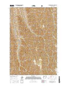
2017 Map of Fingerboard Saddle
USGS Topo · Published 2017About this map
Wallowa National Forest land defines this corner of the state, where steep drainage systems carve into the high country. The landscape is characterized by a series of deep gulches and canyons, including Roy Canyon and Fingerboard Gulch, which feed into major watercourses like Lightning Creek. Significant vertical relief is marked by prominent elevations such as Square Mountain and Kernan Point. For researchers and geologists, the map reveals a network of high-altitude features including the namesake Fingerboard Saddle and Summit Ridge. Water sources in this arid timberland are specifically identified by labels such as Winters Spring and Dad Spring, providing insight into the sparse but critical hydrology of the t2n r49e and t3n r49e townships.
Find a feature on this map
48 named features on this map. Tap any name to fly to it.
Don’t see what you’re looking for? This feature index may not catch every label — zoom into the map to look around manually.
Map Details
Editions of this 2017 Fingerboard Saddle Map
This is the sole edition of this map. No revisions or reprints were ever made.
Other maps of this area

1954 · Imnaha
USGS Topo · 1:62,500

1954 · Kernan Point
USGS Topo · 1:62,500

1955 · Grangeville
USGS Topo · 1:250,000

1959 · Grangeville
USGS Topo · 1:250,000

1963 · Cactus Mtn
USGS Topo · 1:24,000

1963 · Deadhorse Ridge
USGS Topo · 1:24,000

1963 · Wolf Creek
USGS Topo · 1:24,000

1980 · Grangeville
USGS Topo · 1:100,000

1990 · Imnaha
USGS Topo · 1:24,000
1990 · Sleepy Ridge
USGS Topo · 1:24,000