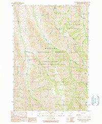
1990 Map of Fingerboard Saddle
USGS Topo · Published 1990About this map
Litch Ranch and Rhodes Creek Ranch are isolated outposts in this landscape, which captures a complex drainage system within the Hells Canyon National Recreation Area during the late twentieth century. High ridges like Haas Ridge and Summit Ridge define the verticality of the terrain, while numerous gulches—including Schleur Gulch and Rowley Gulch—feed into major watercourses like Lightning Creek and Cow Creek.
Find a feature on this map
34 named features on this map. Tap any name to fly to it.
Don’t see what you’re looking for? This feature index may not catch every label — zoom into the map to look around manually.
Map Details
Editions of this 1990 Fingerboard Saddle Map
This is the sole edition of this map. No revisions or reprints were ever made.
Other maps of this area

1954 · Imnaha
USGS Topo · 1:62,500

1954 · Kernan Point
USGS Topo · 1:62,500

1955 · Grangeville
USGS Topo · 1:250,000

1959 · Grangeville
USGS Topo · 1:250,000

1963 · Cactus Mtn
USGS Topo · 1:24,000

1963 · Deadhorse Ridge
USGS Topo · 1:24,000

1963 · Wolf Creek
USGS Topo · 1:24,000

1980 · Grangeville
USGS Topo · 1:100,000

1990 · Imnaha
USGS Topo · 1:24,000
1990 · Sleepy Ridge
USGS Topo · 1:24,000