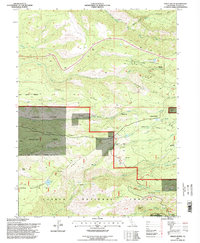
1995 Map of Finley Butte
USGS Topo · Published 1998About this map
Ponderosa Sky Ranch and its landing strip sit at the northern edge of this high-elevation landscape, where the public lands of the Tehama State Wildlife Area and Lassen National Forest meet. This mid-1990s record captures a rugged network of ridges and canyons, including Howell Ridge, Plum Creek Ridge, and Hogback Ridge. The terrain is carved by numerous watercourses such as Paynes Creek, Plum Creek, and the South Fork Antelope Creek.
Find a feature on this map
47 named features on this map. Tap any name to fly to it.
Don’t see what you’re looking for? This feature index may not catch every label — zoom into the map to look around manually.
Map Details
Editions of this 1995 Finley Butte Map
2 editions found
Other maps of this area

1886 · Lassen Peak
USGS Topo · 1:250,000

1892 · Lassen Peak
USGS Topo · 1:250,000

1894 · Lassen Peak
USGS Topo · 1:250,000

1935 · Paynes Creek
USGS Topo · 1:96,000

1941 · Mineral
USGS Topo · 1:125,000
1953 · Panther Spring
USGS Topo · 1:62,500

1955 · Westwood
USGS Topo · 1:250,000

1956 · Lassen Peak
USGS Topo · 1:62,500

1956 · Manton
USGS Topo · 1:62,500

1958 · Westwood
USGS Topo · 1:250,000