
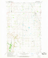
1967 Map of Finley NE
USGS Topo · Published 1969About this map
The agrarian boundary between Grand Forks and Steele counties is captured here in the mid-1960s, a landscape defined by organized township grids and small community hubs. The survey illustrates the rural social fabric of the era, anchored by religious and memorial sites such as West Union Ch in the northern reaches and Hoff Ch further south. Near the center of the map, the Silent Hill Cem stands as a quiet landmark amidst the vast stretches of section lines and field boundaries.
Find a feature on this map
10 named features on this map. Tap any name to fly to it.
Don’t see what you’re looking for? This feature index may not catch every label — zoom into the map to look around manually.
Map Details
Editions of this 1967 Finley NE Map
This is the sole edition of this map. No revisions or reprints were ever made.
Other maps of this area

1936 · Larimore
USGS Topo · 1:62,500

1939 · Niagara
USGS Topo · 1:62,500

1952 · Grand Forks
USGS Topo · 1:250,000

1956 · Grand Forks
USGS Topo · 1:250,000

1963 · Niagara SW
USGS Topo · 1:24,000

1963 · Larimore SW
USGS Topo · 1:24,000

1963 · Logan Center
USGS Topo · 1:24,000

1966 · Grand Forks
USGS Topo · 1:250,000

1967 · Finley
USGS Topo · 1:24,000
1967 · Sharon
USGS Topo · 1:24,000