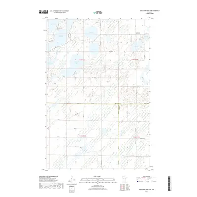
2019 Map of First Crow Wing Lake
USGS Topo · Published 2019About this map
First Crow Wing Lake and its sister basins form a distinctive chain of water bodies in this north-central Minnesota landscape, where the Crow Wing River winds through thick wetlands and glacial terrain. The small community of Badoura sits in the northeast corner, serving as a landmark in a region defined more by its hydrography than its urban footprint. Numerous smaller water bodies like Wolf Lake, Bladder Lake, and Tripp Lake dot the map, connected by drainages such as Bender Cr and Blue Swamp Cr.
Find a feature on this map
59 named features on this map. Tap any name to fly to it.
Don’t see what you’re looking for? This feature index may not catch every label — zoom into the map to look around manually.
Map Details
Editions of this 2019 First Crow Wing Lake Map
This is the sole edition of this map. No revisions or reprints were ever made.
Other maps of this area

1919 · Leader
USGS Topo · 1:62,500

1953 · Brainerd
USGS Topo · 1:250,000

1957 · Brainerd
USGS Topo · 1:250,000

1958 · Brainerd
USGS Topo · 1:250,000

1965 · Brainerd
USGS Topo · 1:250,000
1969 · Nimrod
USGS Topo · 1:24,000

1969 · Burgen Lake
USGS Topo · 1:24,000

1970 · Spider Lake
USGS Topo · 1:24,000

1970 · Nevis
USGS Topo · 1:24,000

1970 · Dorset
USGS Topo · 1:24,000