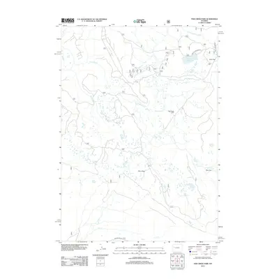
2012 Map of Fish Creek Park
USGS Topo · Published 2012About this map
Union Pass serves as a central geographic anchor on this Wyoming landscape, marking a significant high-altitude corridor within the Wind River Range. The terrain is defined by the headwaters of several drainages, including the northward-flowing Salt Cr and the eastern-running S Fork Fish Cr. Extensive open meadows like Fish Creek Park and Ryan Park provide breaks in the high-elevation topography, while the prominent Piñon Ridge divides the southern basins near Crow Cr. The area is accessible via rugged routes such as the Lake of the Woods Rd and Roaring Fork Rd, which link the high-country lakes, notably the Lake of the Woods, to the surrounding wilderness. This map documents a region characterized by complex hydrology and traditional mountain crossings used for seasonal access.
Find a feature on this map
13 named features on this map. Tap any name to fly to it.
Don’t see what you’re looking for? This feature index may not catch every label — zoom into the map to look around manually.
Map Details
Editions of this 2012 Fish Creek Park Map
This is the sole edition of this map. No revisions or reprints were ever made.
Other maps of this area

1902 · Mt Leidy
USGS Topo · 1:125,000

1905 · Younts Peak
USGS Topo · 1:125,000

1907 · Younts Peak
USGS Topo · 1:125,000

1907 · Gros Ventre
USGS Topo · 1:125,000

1909 · Fremont Peak
USGS Topo · 1:125,000

1910 · Gros Ventre
USGS Topo · 1:125,000

1955 · Driggs
USGS Topo · 1:250,000

1955 · Thermopolis
USGS Topo · 1:250,000

1956 · Warm Spring Mountain
USGS Topo · 1:24,000

1956 · Fish Lake
USGS Topo · 1:24,000