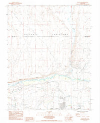
1984 Map of Fish Slough
USGS Topo · Published 1984About this map
The Volcanic Tableland dominates the northern reaches of this landscape, its elevated terrain dropping sharply at the Chalk Bluff into the valley below. This transition defines the hydrologic character of the region, where the Owens River meanders through the lowlands of Pleasant Valley and the broader Owens Valley. To the east, the watery margins of Fish Slough provide a stark contrast to the surrounding arid tableland. Near the southern edge, the community of Bishop is visible alongside the Bishop Paute Indian Res, illustrating the historic settlement patterns at the foot of the Eastern Sierra. The map also documents local infrastructure such as Casa Diablo Road and the water management systems of the North Fork Bishop Creek, alongside leisure sites like the Millpond Recreation Area. Numerous prospects scattered across the eastern slopes indicate the area's legacy of mineral exploration.
Find a feature on this map
22 named features on this map. Tap any name to fly to it.
Don’t see what you’re looking for? This feature index may not catch every label — zoom into the map to look around manually.
Map Details
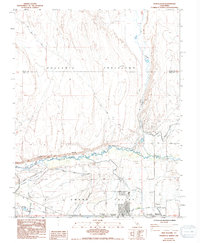
Editions of this 1984 Fish Slough Map
2 editions found
Other maps of this area

1912 · Mt. Goddard
USGS Topo · 1:125,000

1913 · Bishop
USGS Topo · 1:125,000

1914 · Mt. Morrison
USGS Topo · 1:125,000

1917 · White Mountain
USGS Topo · 1:125,000

1947 · Mariposa
USGS Topo · 1:250,000

1948 · Mariposa
USGS Topo · 1:250,000

1949 · Mt. Tom
USGS Topo · 1:62,500

1949 · Bishop
USGS Topo · 1:62,500

1951 · Mt. Tom
USGS Topo · 1:62,500

1951 · Bishop
USGS Topo · 1:62,500
Featured Places
- Bishop, CA
- Dixon Lane–Meadow Creek, Dixon Lane-Meadow Creek
- West Bishop, CA
- Brockmans Corner, Dixon Lane-Meadow Creek