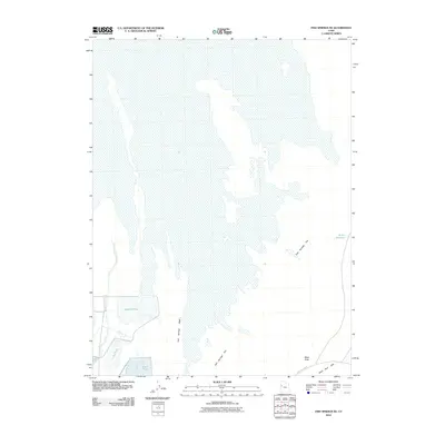
2010 Map of Fish Springs NE
USGS Topo · Published 2010About this map
Pony Express Rd cuts across the southeastern corner of this Tooele County landscape, tracing a legendary western corridor through the high desert. The map is dominated by the expansive Fish Springs Flat, a low-lying basin where water management is evident in several named wetland features. These include Gadwall Pool, Ibis Pool, and Egret Pool, which suggest a concentrated effort to maintain avian habitats or managed water levels in an otherwise arid environment. Along the eastern edge, the Staley Reservoir and the rising elevation of the Black Rock Hills provide topographical contrast to the basin floor. The drainage of Fish Springs Wash further illustrates the hydrological patterns that define this section of the Great Basin, where isolated landmarks like Black Rock served as crucial navigational waypoints for travelers in earlier eras.
Find a feature on this map
9 named features on this map. Tap any name to fly to it.
Don’t see what you’re looking for? This feature index may not catch every label — zoom into the map to look around manually.
Map Details
Editions of this 2010 Fish Springs NE Map
This is the sole edition of this map. No revisions or reprints were ever made.
Other maps of this area

1908 · Fish Springs
USGS Topo · 1:250,000

1910 · Fish Springs
USGS Topo · 1:250,000

1953 · Dugway Range
USGS Topo · 1:62,500

1953 · Dugway Range NW
USGS Topo · 1:24,000

1953 · Tooele
USGS Topo · 1:250,000

1953 · Delta
USGS Topo · 1:250,000

1954 · Dugway Proving Ground SW
USGS Topo · 1:24,000

1954 · Granite Peak SE
USGS Topo · 1:24,000

1955 · Tooele
USGS Topo · 1:250,000

1958 · Delta
USGS Topo · 1:250,000