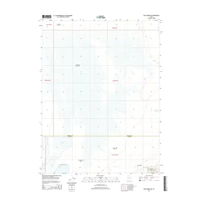
2014 Map of Fish Springs NE
USGS Topo · Published 2014About this map
Great Salt Lake Desert defines the vast, low-lying character of this western Utah landscape, where the boundary between Tooele Co and Juab Co cuts through an arid basin. The map reveals a specialized hydraulic environment on the edge of the Fish Springs Flat, characterized by named water features like Gadwall Pool and Ibis Pool. These pools and the accompanying Shoveler Pool Rte 107 suggest a managed wetland or wildlife area contrasting with the surrounding salt flats. To the southeast, the terrain rises toward Black Rock Hills and the prominent landmark of Black Rock. The presence of the Pony Exp trail and Starlight Rd indicates the historical and modern transit corridors that have skirted the edge of the desert for generations, linking remote springs and overlooks across the Fish Springs Wash.
Find a feature on this map
12 named features on this map. Tap any name to fly to it.
Don’t see what you’re looking for? This feature index may not catch every label — zoom into the map to look around manually.
Map Details
Editions of this 2014 Fish Springs NE Map
This is the sole edition of this map. No revisions or reprints were ever made.
Other maps of this area

1908 · Fish Springs
USGS Topo · 1:250,000

1910 · Fish Springs
USGS Topo · 1:250,000

1953 · Dugway Range
USGS Topo · 1:62,500

1953 · Dugway Range NW
USGS Topo · 1:24,000

1953 · Tooele
USGS Topo · 1:250,000

1953 · Delta
USGS Topo · 1:250,000

1954 · Dugway Proving Ground SW
USGS Topo · 1:24,000

1954 · Granite Peak SE
USGS Topo · 1:24,000

1955 · Tooele
USGS Topo · 1:250,000

1958 · Delta
USGS Topo · 1:250,000