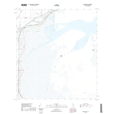
2018 Map of Fisheating Bay
USGS Topo · Published 2018About this map
Lakeport stands as a primary point of reference along the northwestern shores of Lake Okeechobee in this 2018 survey of Glades County. The landscape is defined by the massive Herbert Hoover Dike, which separates the inland agricultural and residential developments from the expansive marshlands and open waters of the lake. To the west, the Florida National Scenic Trail winds through the region, following the dike and providing a terrestrial corridor through a landscape largely dominated by water and wetland.
Find a feature on this map
30 named features on this map. Tap any name to fly to it.
Don’t see what you’re looking for? This feature index may not catch every label — zoom into the map to look around manually.
Map Details
Editions of this 2018 Fisheating Bay Map
This is the sole edition of this map. No revisions or reprints were ever made.
Other maps of this area

1953 · Brighton SW
USGS Topo · 1:24,000

1953 · Brighton SE
USGS Topo · 1:24,000

1953 · Okeechobee SW
USGS Topo · 1:24,000

1956 · West Palm Beach
USGS Topo · 1:250,000

1956 · Fort Pierce
USGS Topo · 1:250,000

1957 · West Palm Beach
USGS Topo · 1:250,000

1958 · Fort Pierce
USGS Topo · 1:250,000

1958 · West Palm Beach
USGS Topo · 1:250,000

1959 · Fort Pierce
USGS Topo · 1:250,000

1970 · Moore Haven
USGS Topo · 1:24,000