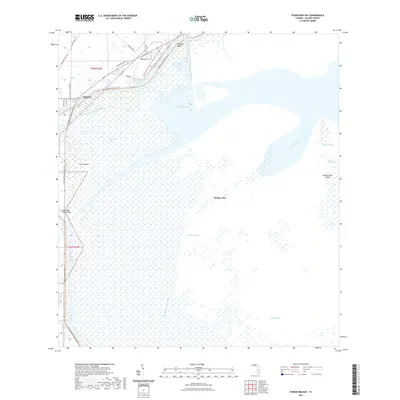
2021 Map of Fisheating Bay
USGS Topo · Published 2021About this map
Lakeport and the surrounding Glades County wetlands dominate this modern survey of the western shores of Lake Okeechobee. The landscape is defined by the managed movement of water through the Rim Canal, Old Moore Haven Canal, and Harney Pond Canal, which frame the low-lying settlements of Big Bear Beach and the residential streets near Miller Dr. This area serves as a critical point for the Florida National Scenic Trail, which skirts the lake margin before crossing the Fisheating Creek Bridge at Fisheating Creek.
Find a feature on this map
29 named features on this map. Tap any name to fly to it.
Don’t see what you’re looking for? This feature index may not catch every label — zoom into the map to look around manually.
Map Details
Editions of this 2021 Fisheating Bay Map
This is the sole edition of this map. No revisions or reprints were ever made.
Other maps of this area

1953 · Brighton SW
USGS Topo · 1:24,000

1953 · Brighton SE
USGS Topo · 1:24,000

1953 · Okeechobee SW
USGS Topo · 1:24,000

1956 · West Palm Beach
USGS Topo · 1:250,000

1956 · Fort Pierce
USGS Topo · 1:250,000

1957 · West Palm Beach
USGS Topo · 1:250,000

1958 · Fort Pierce
USGS Topo · 1:250,000

1958 · West Palm Beach
USGS Topo · 1:250,000

1959 · Fort Pierce
USGS Topo · 1:250,000

1970 · Moore Haven
USGS Topo · 1:24,000