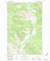
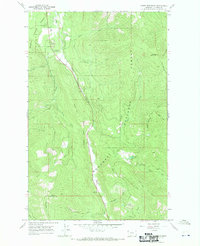
1966 Map of Fisher Mountain
USGS Topo · Published 1984About this map
Fisher River carves a deep valley through the heart of the Kootenai National Forest, serving as a primary corridor for both natural drainage and industrial transport in this part of Lincoln County. The Burlington Northern railroad follows the river's eastern bank, punctuated by the Fisher River Siding near the confluence with Wolf Creek. This area illustrates the specialized mountain infrastructure of the mid-1960s, where traditional pack routes like the Fisher Mountain Trail (Pack) and Divide Trail (Pack) navigate the steep elevations between summits like Fisher Mountain and Lightning Peak. The landscape is defined by its drainage network, with numerous tributaries including McKillop Creek and Snell Creek feeding into the main river channel. Small signs of human utility appear in the form of a Gaging Sta and a Gravel Pit, supporting the remote operations within the national forest boundary.
Find a feature on this map
23 named features on this map. Tap any name to fly to it.
Don’t see what you’re looking for? This feature index may not catch every label — zoom into the map to look around manually.
Map Details
Editions of this 1966 Fisher Mountain Map
2 editions found
Other maps of this area

1920 · Jennings
USGS Topo · 1:125,000

1935 · Thompson Lakes
USGS Topo · 1:96,000

1942 · Thompson Lakes
USGS Topo · 1:125,000

1957 · Kalispell
USGS Topo · 1:250,000

1960 · Kalispell
USGS Topo · 1:250,000

1961 · Kalispell
USGS Topo · 1:250,000

1963 · Swede Mountain
USGS Topo · 1:24,000
1963 · Tony Peak
USGS Topo · 1:24,000
1963 · Richards Mountain
USGS Topo · 1:24,000
1966 · Horse Mountain
USGS Topo · 1:24,000