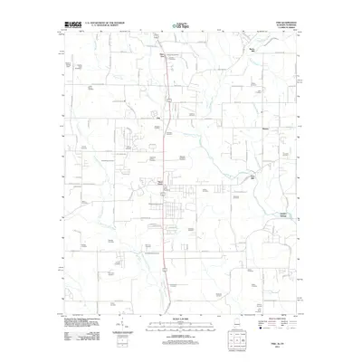
2011 Map of Fisk
USGS Topo · Published 2011About this map
The State Line between Alabama and Tennessee bisects the northern reaches of this landscape, where small settlements like Fisk and Skinem are scattered across a complex network of waterways. The Hazel Green community serves as a central hub, anchored by the Hazel Green Post Office, while the agricultural character of the region is underscored by numerous family-named burial grounds. Genealogists will find a wealth of data in these sites, including the Welbourn-King Cemetery, James Moore Cemetery, and the Pruit-McCaa Cemetery.
Find a feature on this map
127 named features on this map. Tap any name to fly to it.
Don’t see what you’re looking for? This feature index may not catch every label — zoom into the map to look around manually.
Map Details
Editions of this 2011 Fisk Map
This is the sole edition of this map. No revisions or reprints were ever made.
Other maps of this area

1888 · Scottsboro
USGS Topo · 1:125,000

1888 · Huntsville
USGS Topo · 1:125,000

1892 · Huntsville
USGS Topo · 1:125,000

1892 · Scottsboro
USGS Topo · 1:125,000

1936 · Jeff
USGS Topo · 1:24,000

1936 · Flintville
USGS Topo · 1:24,000

1936 · Taft
USGS Topo · 1:24,000

1936 · Meridianville
USGS Topo · 1:24,000

1936 · Fisk
USGS Topo · 1:24,000

1936 · Lincoln
USGS Topo · 1:24,000