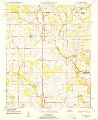
1951 Map of Fisk
USGS Topo · Published 1951About this map
Hazel Green and the surrounding agricultural landscape of northern Madison County appear here as they were just after the war, marked by an intricate network of small family cemeteries and country schools. The Huntsville Meridian Road serves as the primary north-south artery, passing through the settlements of Fisk and Stegers Store. This 1948 field examination by the Tennessee Valley Authority records the rural character of the area before the significant expansion of nearby Huntsville, showing a landscape defined by the winding course of the Flint River and its various tributaries like the West Fork Flint River.
Find a feature on this map
45 named features on this map. Tap any name to fly to it.
Don’t see what you’re looking for? This feature index may not catch every label — zoom into the map to look around manually.
Map Details
Editions of this 1951 Fisk Map
This is the sole edition of this map. No revisions or reprints were ever made.
Other maps of this area

1888 · Scottsboro
USGS Topo · 1:125,000

1888 · Huntsville
USGS Topo · 1:125,000

1892 · Huntsville
USGS Topo · 1:125,000

1892 · Scottsboro
USGS Topo · 1:125,000

1936 · Jeff
USGS Topo · 1:24,000

1936 · Flintville
USGS Topo · 1:24,000

1936 · Taft
USGS Topo · 1:24,000

1936 · Meridianville
USGS Topo · 1:24,000

1936 · Fisk
USGS Topo · 1:24,000

1936 · Lincoln
USGS Topo · 1:24,000