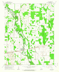
1962 Map of Fisk
USGS Topo · Published 1963About this map
Fisk sits at the heart of this landscape, positioned where the Missouri Pacific railroad crosses the meandering St Francis River. The map reveals a complex water management system designed to drain the lowlands of St Francois and Duck Creek, dominated by an extensive network of engineered waterways such as Mingo Ditch and Johnny Ditch. This grid of ditches transformed the area's hydrology to support agriculture across the Butler and Stoddard County line.
Find a feature on this map
24 named features on this map. Tap any name to fly to it.
Don’t see what you’re looking for? This feature index may not catch every label — zoom into the map to look around manually.
Map Details
Editions of this 1962 Fisk Map
2 editions found
Other maps of this area

1934 · Puxico
USGS Topo · 1:62,500

1935 · Poplar Bluff
USGS Topo · 1:62,500

1935 · Harviell
USGS Topo · 1:62,500

1939 · Puxico
USGS Topo · 1:62,500

1939 · Poplar Bluff
USGS Topo · 1:62,500

1940 · Valley Ridge
USGS Topo · 1:62,500

1949 · Poplar Bluff
USGS Topo · 1:62,500

1956 · Valley Ridge
USGS Topo · 1:62,500

1957 · Poplar Bluff
USGS Topo · 1:250,000

1959 · Poplar Bluff
USGS Topo · 1:250,000