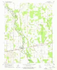
1962 Map of Fisk
USGS Topo · Published 1977About this map
Fisk serves as the central hub of this Missouri landscape, situated where the Missouri Pacific railroad crosses the winding St Francis River. The topography reveals an extensively engineered drainage system, where natural watercourses like Panther Slough and Run are supplemented by a grid of man-made channels including Mingo Ditch, Johnny Ditch, and Coal Oil Ditch. These ditches underscore the transition of the Duck Creek area into productive agricultural land during the mid-20th century.
Find a feature on this map
25 named features on this map. Tap any name to fly to it.
Don’t see what you’re looking for? This feature index may not catch every label — zoom into the map to look around manually.
Map Details
Editions of this 1962 Fisk Map
2 editions found
Other maps of this area

1934 · Puxico
USGS Topo · 1:62,500

1935 · Poplar Bluff
USGS Topo · 1:62,500

1935 · Harviell
USGS Topo · 1:62,500

1939 · Puxico
USGS Topo · 1:62,500

1939 · Poplar Bluff
USGS Topo · 1:62,500

1940 · Valley Ridge
USGS Topo · 1:62,500

1949 · Poplar Bluff
USGS Topo · 1:62,500

1956 · Valley Ridge
USGS Topo · 1:62,500

1957 · Poplar Bluff
USGS Topo · 1:250,000

1959 · Poplar Bluff
USGS Topo · 1:250,000