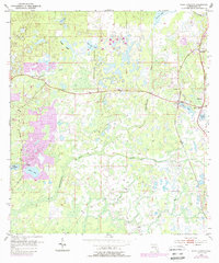
1954 Map of Fivay Junction
USGS Topo · Published 1988About this map
The Pithlachascotee River and the upper reaches of the Anclote River define the watery landscape of central Pasco County in the mid-1950s. This survey, later updated with photorevisions, documents a region defined by its numerous wetlands and small water bodies such as Cabbage Slough, Bee Tree Pond, and Rock Lake. Small settlements like Gowers Corner and Fivay Junction serve as the primary crossroads for the area. Genealogists and local researchers will find the Fivay Cem and Bethel Ch located near the eastern boundary, providing specific landmarks for family history. The western portion of the map shows a distinct pattern of residential growth around Moon Lake and West Moon Lake, contrasting with the more dispersed rural character of the eastern marshlands and the shores of Crews Lake.
Find a feature on this map
19 named features on this map. Tap any name to fly to it.
Don’t see what you’re looking for? This feature index may not catch every label — zoom into the map to look around manually.
Map Details
Editions of this 1954 Fivay Junction Map
4 editions found

Other maps of this area

1943 · Odessa
USGS Topo · 1:24,000

1943 · Elfers
USGS Topo · 1:24,000

1943 · Lutz
USGS Topo · 1:24,000

1944 · Elfers
USGS Topo · 1:31,680

1944 · Lutz
USGS Topo · 1:31,680

1944 · Odessa
USGS Topo · 1:31,680

1948 · Elfers
USGS Topo · 1:25,000

1949 · Odessa
USGS Topo · 1:25,000

1954 · Ehren
USGS Topo · 1:24,000

1954 · Port Richey
USGS Topo · 1:24,000