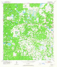
1954 Map of Fivay
USGS Topo · Published 1967About this map
The Pithlachascotee River and the upper reaches of the Anclote River define this mid-century landscape in western Pasco County. This 1954 survey captures a rural Florida interior dominated by an intricate network of cypress ponds, sloughs, and small lakes like Moon Lake and Crews Lake. The settlement pattern is sparse, concentrated at rural crossroads and along the Seaboard Air Line railroad. Small community hubs are marked by Greenfield and Gowers Corner, providing a record of the region before the rapid suburban expansion of the later 20th century.
Find a feature on this map
20 named features on this map. Tap any name to fly to it.
Don’t see what you’re looking for? This feature index may not catch every label — zoom into the map to look around manually.
Map Details
Editions of this 1954 Fivay Map
4 editions found

Other maps of this area

1943 · Odessa
USGS Topo · 1:24,000

1943 · Elfers
USGS Topo · 1:24,000

1943 · Lutz
USGS Topo · 1:24,000

1944 · Elfers
USGS Topo · 1:31,680

1944 · Lutz
USGS Topo · 1:31,680

1944 · Odessa
USGS Topo · 1:31,680

1948 · Elfers
USGS Topo · 1:25,000

1949 · Odessa
USGS Topo · 1:25,000

1954 · Ehren
USGS Topo · 1:24,000

1954 · Port Richey
USGS Topo · 1:24,000