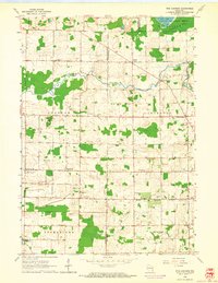
1959 Map of Five Corners
USGS Topo · Published 1964About this map
Kirchhayn and the surrounding rural crossroads of Ozaukee and Washington Counties appear here in a landscape defined by small-scale agriculture and early preservation efforts. The northern reaches are dominated by the Cedarburg Bog Wildlife Refuge, a distinct natural feature containing Mud Lake, which stands in contrast to the heavily gridded farm plots that characterize the townships of Jackson, Cedarburg, and Mequon. These farming communities are anchored by local institutions like David Star Ch and a network of district schools, including Sherman Sch and Elm Tree Sch.
Find a feature on this map
31 named features on this map. Tap any name to fly to it.
Don’t see what you’re looking for? This feature index may not catch every label — zoom into the map to look around manually.
Map Details
Editions of this 1959 Five Corners Map
4 editions found
Other maps of this area

1892 · Milwaukee
USGS Topo · 1:62,500

1892 · Waukesha
USGS Topo · 1:62,500

1892 · Port Washington
USGS Topo · 1:62,500

1901 · Milwaukee
USGS Topo · 1:62,500

1901 · Waukesha
USGS Topo · 1:62,500

1904 · West Bend
USGS Topo · 1:62,500

1904 · Port Washington
USGS Topo · 1:62,500

1906 · Waukesha
USGS Topo · 1:62,500

1906 · Milwaukee
USGS Topo · 1:62,500

1954 · Milwaukee
USGS Topo · 1:250,000