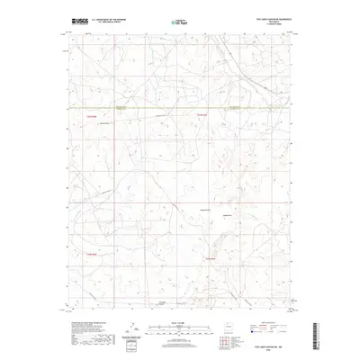
2020 Map of Five Lakes Canyon NE
USGS Topo · Published 2020About this map
Badland Hills and the winding drainages of the high desert dominate this corner of the New Mexico landscape. The map centers on the border between Sandoval and Rio Arriba counties, where the terrain is carved by deep canyons and seasonal watercourses. Notable topographic features include Menfee Canyon and Medio Canyon, which slice through the plateau toward the drainage of Arroyo Valles. The area is navigated by a network of Indian Service roads, such as Indian Svc Rte 20 and Indian Svc Rte 22, which provide the primary access through this sparsely developed region. In the northeast, the land slopes toward Largo Creek and Cañada Larga, illustrating the complex hydrological patterns that define this arid environment. The map captures a transition point in the landscape, moving from the rugged breaks of Five Lakes Canyon into broader valley floors.
Find a feature on this map
16 named features on this map. Tap any name to fly to it.
Don’t see what you’re looking for? This feature index may not catch every label — zoom into the map to look around manually.
Map Details
Editions of this 2020 Five Lakes Canyon NE Map
This is the sole edition of this map. No revisions or reprints were ever made.
Other maps of this area

1889 · Largo
USGS Topo · 1:250,000

1895 · Largo
USGS Topo · 1:250,000

1909 · Gallina
USGS Topo · 1:125,000

1940 · Cuba
USGS Topo · 1:62,500

1943 · Cuba
USGS Topo · 1:62,500

1954 · Aztec
USGS Topo · 1:250,000

1955 · Llaves
USGS Topo · 1:62,500

1958 · Aztec
USGS Topo · 1:250,000

1962 · Aztec
USGS Topo · 1:250,000

1963 · Lindrith
USGS Topo · 1:24,000