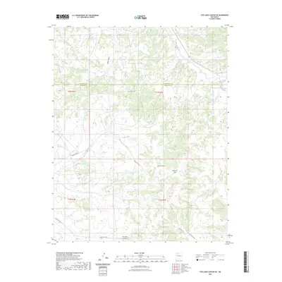
2023 Map of Five Lakes Canyon NE
USGS Topo · Published 2023About this map
Badland Hills and high desert plateaus dominate this section of the Jicarilla Apache territory, where the county line between Rio Arriba and Sandoval counties bisects the landscape. The drainage network is characterized by deep erosional features like Five Lakes Canyon, Medio Canyon, and Menfee Canyon, which funnel seasonal runoff toward Cañada Larga. The area's connectivity is defined by established Bureau of Indian Affairs routes, specifically Indian Svc Rte 20 and Indian Svc Rte 22, which navigate the complex topography. This modern survey illustrates the enduring rural character of this high-elevation region, where Arroyo Valles and Largo Creek shape the dry-land hydrology essential to the local environment and its inhabitants.
Find a feature on this map
15 named features on this map. Tap any name to fly to it.
Don’t see what you’re looking for? This feature index may not catch every label — zoom into the map to look around manually.
Map Details
Editions of this 2023 Five Lakes Canyon NE Map
This is the sole edition of this map. No revisions or reprints were ever made.
Other maps of this area

1889 · Largo
USGS Topo · 1:250,000

1895 · Largo
USGS Topo · 1:250,000

1909 · Gallina
USGS Topo · 1:125,000

1940 · Cuba
USGS Topo · 1:62,500

1943 · Cuba
USGS Topo · 1:62,500

1954 · Aztec
USGS Topo · 1:250,000

1955 · Llaves
USGS Topo · 1:62,500

1958 · Aztec
USGS Topo · 1:250,000

1962 · Aztec
USGS Topo · 1:250,000

1963 · Lindrith
USGS Topo · 1:24,000