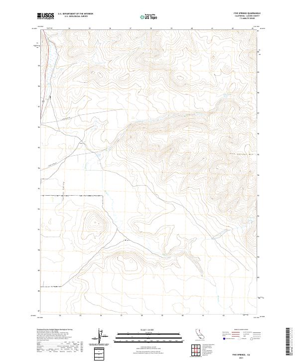
2021 Map of Five Springs
USGS Topo · Published 2021About this map
Secret Valley and the surrounding high desert terrain of Lassen County dominate this modern topographic survey. The landscape is defined by its drainage systems, most notably Stony Cr and Deep Cr, which carve through the arid plateaus. In the northeastern portion of the sheet, Five Springs Mtn rises above the basin, while the namesake Five Springs and Stony Creek Spring indicate the critical water sources that have historically supported life in this dry environment. Human activity is marked by sparse infrastructure, including Shinn Ranch Rd and Stoney Creek Rd, which provide access to the remote ranchlands. The map reveals the classic Public Land Survey System grid with township markers such as t31n r16e, illustrating how this vast California territory was partitioned for settlement and grazing.
Find a feature on this map
13 named features on this map. Tap any name to fly to it.
Don’t see what you’re looking for? This feature index may not catch every label — zoom into the map to look around manually.
Map Details
Editions of this 2021 Five Springs Map
This is the sole edition of this map. No revisions or reprints were ever made.
Other maps of this area

1886 · Honey Lake
USGS Topo · 1:250,000

1891 · Honey Lake
USGS Topo · 1:250,000

1893 · Honey Lake
USGS Topo · 1:250,000

1954 · Wendel
USGS Topo · 1:62,500

1954 · Litchfield
USGS Topo · 1:62,500

1954 · Karlo
USGS Topo · 1:62,500

1954 · Shinn Mountain
USGS Topo · 1:62,500

1955 · Westwood
USGS Topo · 1:250,000

1958 · Westwood
USGS Topo · 1:250,000

1959 · Westwood
USGS Topo · 1:250,000