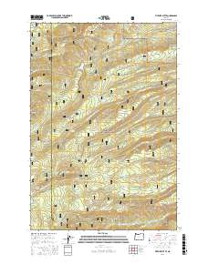
2017 Map of Fivemile Butte
USGS Topo · Published 2017About this map
The Mount Hood National Forest landscape across the Hood River and Wasco county line is defined by a dense network of water sources and forestry infrastructure. Numerous springs, such as Knebal Spring, Pollywog Spring, and Wampus Springs, feed the complex drainage systems of Middle Fork Fivemile Creek and South Fork Mill Creek. This 2017 survey details the water management of the region through features like Crow Creek Reservoir and the Wolf Run Ditch. High-elevation points like Fivemile Butte and Joes Point overlook a terrain marked by steep descents such as Suicide Grade and Hillary Grade. The presence of several established forest service routes, including Dufur Mill Road and Logging Gulch Road, highlights the area's continued use for timber management and backcountry access, while Camp-Baldwin Lake serves as a notable recreational landmark within the forest's interior.
Find a feature on this map
57 named features on this map. Tap any name to fly to it.
Don’t see what you’re looking for? This feature index may not catch every label — zoom into the map to look around manually.
Map Details
Editions of this 2017 Fivemile Butte Map
This is the sole edition of this map. No revisions or reprints were ever made.
Other maps of this area

1924 · Mount Hood
USGS Topo · 1:125,000

1926 · Hood River
USGS Topo · 1:125,000

1927 · Mount Hood
USGS Topo · 1:125,000

1929 · Hood River
USGS Topo · 1:125,000

1930 · Dufur
USGS Topo · 1:125,000

1934 · Dufur
USGS Topo · 1:125,000

1934 · The Dalles
USGS Topo · 1:125,000

1953 · The Dalles
USGS Topo · 1:250,000

1956 · The Dalles
USGS Topo · 1:250,000

1957 · The Dalles
USGS Topo · 1:250,000