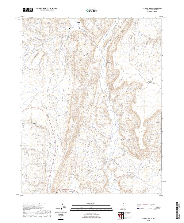
2023 Map of Fivemile Valley
USGS Topo · Published 2023About this map
Paria and its surrounding desert topography define this corner of southern Utah, where the Paria River and Cottonwood Creek carve through the sedimentary landscape. This 2023 survey documents a region defined by dramatic geological formations, including The Rimrocks and the vast Brigham Plains. The presence of the Pahreah Cem near the old settlement site provides a vital point of reference for genealogists and local historians tracking the early pioneers who attempted to farm this arid valley.
Find a feature on this map
13 named features on this map. Tap any name to fly to it.
Don’t see what you’re looking for? This feature index may not catch every label — zoom into the map to look around manually.
Map Details
Editions of this 2023 Fivemile Valley Map
This is the sole edition of this map. No revisions or reprints were ever made.
Other maps of this area

1886 · Kanab
USGS Topo · 1:250,000

1886 · Escalante
USGS Topo · 1:250,000

1953 · Cedar City
USGS Topo · 1:250,000

1954 · Buckskin Gulch NE
USGS Topo · 1:24,000

1954 · Buckskin Gulch SE
USGS Topo · 1:24,000

1954 · Paria NW
USGS Topo · 1:24,000
1954 · Paria SW
USGS Topo · 1:24,000

1954 · Buckskin Gulch
USGS Topo · 1:62,500

1954 · Paria
USGS Topo · 1:62,500

1955 · The Cockscob SW
USGS Topo · 1:24,000