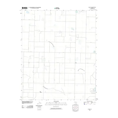
2010 Map of Flagg
USGS Topo · Published 2010About this map
North Fork Running Water Draw and Running Water Draw shape the drainage patterns of this high plains landscape in Castro County. The area is defined by a rigid grid of agricultural roads, including Co RD 623 and Fm 1055, which connect the small community centers of Flagg and Big Square. This 2010 survey illustrates the deep integration of water management and road infrastructure in the Texas Panhandle, where numerous playa lakes and seasonal basins dot the terrain. The map provides a precise layout of rural holdings and thoroughfares such as Fm 145, offering a clear view of the settlement pattern at the start of the decade.
Find a feature on this map
19 named features on this map. Tap any name to fly to it.
Don’t see what you’re looking for? This feature index may not catch every label — zoom into the map to look around manually.
Map Details
Editions of this 2010 Flagg Map
This is the sole edition of this map. No revisions or reprints were ever made.
Other maps of this area

1954 · Clovis
USGS Topo · 1:250,000

1958 · Clovis
USGS Topo · 1:250,000

1962 · Dodd NE
USGS Topo · 1:24,000

1963 · Flagg
USGS Topo · 1:24,000

1963 · Lazbuddie
USGS Topo · 1:24,000

1963 · Dodd SE
USGS Topo · 1:24,000

1963 · Dodd
USGS Topo · 1:24,000
1963 · Lazbuddie SE
USGS Topo · 1:24,000

1965 · Dimmitt
USGS Topo · 1:24,000

1965 · Dimmitt SW
USGS Topo · 1:24,000