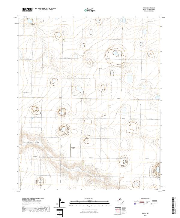
2022 Map of Flagg
USGS Topo · Published 2022About this map
Running Water Draw carves a distinct path through the High Plains landscape of Castro County, providing the primary topographic relief in an area otherwise defined by large-scale agricultural parcels. The small settlement of Flagg sits at the junction of several county roads, serving as a quiet focal point for the surrounding farming community. This 2022 survey illustrates the modern rural infrastructure of the Texas Panhandle, where aviation and irrigation are central to local industry, evidenced by the private Ott Farms Airport. A rigid grid of farm-to-market roads, including Fm 145 and Fm 1055, organizes the territory into expansive sections. The presence of numerous small basins and the meandering course of the draw highlight the complex drainage patterns that characterize this portion of the Llano Estacado.
Find a feature on this map
19 named features on this map. Tap any name to fly to it.
Don’t see what you’re looking for? This feature index may not catch every label — zoom into the map to look around manually.
Map Details
Editions of this 2022 Flagg Map
This is the sole edition of this map. No revisions or reprints were ever made.
Other maps of this area

1954 · Clovis
USGS Topo · 1:250,000

1958 · Clovis
USGS Topo · 1:250,000

1962 · Dodd NE
USGS Topo · 1:24,000

1963 · Flagg
USGS Topo · 1:24,000

1963 · Lazbuddie
USGS Topo · 1:24,000

1963 · Dodd SE
USGS Topo · 1:24,000

1963 · Dodd
USGS Topo · 1:24,000
1963 · Lazbuddie SE
USGS Topo · 1:24,000

1965 · Dimmitt
USGS Topo · 1:24,000

1965 · Dimmitt SW
USGS Topo · 1:24,000