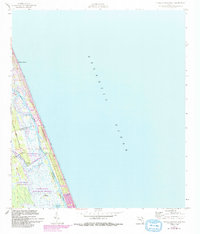
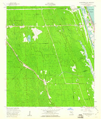
1956 Map of Flagler Beach East
USGS Topo · Published 1993About this map
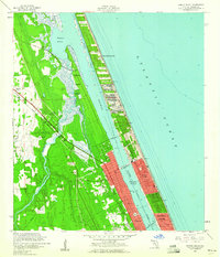
The coastal strip of Florida's northeast shore is defined by the thin barrier between the Atlantic Ocean and the sprawling marshlands of the Intracoastal Waterway. This area, updated in the early 1990s from original 1950s surveys, showcases a landscape of protected wetlands and burgeoning beachside settlements. The town of Flagler Beach anchors the northern portion, while the southern reaches transition into preserved ecosystems like the Tomoka Marsh State Aquatic Preserve.
Find a feature on this map
19 named features on this map. Tap any name to fly to it.
Don’t see what you’re looking for? This feature index may not catch every label — zoom into the map to look around manually.
Map Details
Editions of this 1956 Flagler Beach East Map
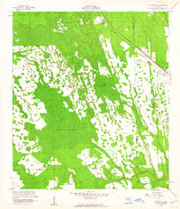
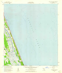
Other maps of this area

1927 · Matanzas
USGS Topo · 1:48,000

1937 · Ormond
USGS Topo · 1:48,000

1943 · Matanzas
USGS Topo · 1:62,500

1944 · Ormond
USGS Topo · 1:62,500

1944 · Matanzas
USGS Topo · 1:62,500

1954 · Daytona Beach
USGS Topo · 1:250,000
1956 · Favoretta
USGS Topo · 1:24,000
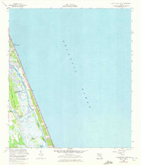
1956 · Flagler Beach East
USGS Topo · 1:24,000
1956 · Flagler Beach West
USGS Topo · 1:24,000
1956 · Ormond Beach
USGS Topo · 1:24,000