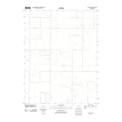
2010 Map of Flagler NE
USGS Topo · Published 2010About this map
Hell Creek and Buffalo Creek wind through the expansive high plains of northeastern Colorado in this 2010 U.S. Geological Survey representation. The landscape of Kit Carson County is defined by a strict section-line grid of rural corridors, ranging from County Road JJ at the northern boundary to County Road BB in the south. This rectilinear road network reflects the enduring influence of the Public Land Survey System on the agricultural geography of the region. The map highlights the subtle drainage patterns of the prairie, where seasonal watercourses like Hell Creek carve gentle depressions across the terrain, serving as the primary natural breaks in an otherwise highly organized human landscape of section roads and farm plots.
Find a feature on this map
19 named features on this map. Tap any name to fly to it.
Don’t see what you’re looking for? This feature index may not catch every label — zoom into the map to look around manually.
Map Details
Editions of this 2010 Flagler NE Map
This is the sole edition of this map. No revisions or reprints were ever made.
Other maps of this area

1954 · Limon
USGS Topo · 1:250,000

1957 · Limon
USGS Topo · 1:250,000

1958 · Limon
USGS Topo · 1:250,000

1977 · Thurman
USGS Topo · 1:24,000

1977 · Anton SE
USGS Topo · 1:24,000

1977 · Cope SW
USGS Topo · 1:24,000

1979 · Flagler SW
USGS Topo · 1:24,000

1979 · Flagler NW
USGS Topo · 1:24,000

1979 · Flagler
USGS Topo · 1:24,000
1979 · Flagler NE
USGS Topo · 1:24,000