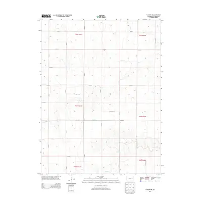
2013 Map of Flagler NE
USGS Topo · Published 2013About this map
Hell Cr and Buffalo Cr carve subtle drainages across this high plains landscape of Kit Carson County, following the natural contours of the eastern Colorado steppe. The 2013 survey reveals a highly structured environment defined by the Public Land Survey System, where a rigid grid of section lines and county roads imposes order on the open range. This map captures the geographic intersection of several townships, including t007s r051w and t007s r050w. The transportation network is entirely composed of systematic rural routes, such as Co Road JJ and Co Road DD, which facilitate movement between scattered homesteads and agricultural tracts. This era of mapping highlights the persistent reliance on the section-line road system for local connectivity in an area primarily shaped by dryland farming and ranching.
Find a feature on this map
27 named features on this map. Tap any name to fly to it.
Don’t see what you’re looking for? This feature index may not catch every label — zoom into the map to look around manually.
Map Details
Editions of this 2013 Flagler NE Map
This is the sole edition of this map. No revisions or reprints were ever made.
Other maps of this area

1954 · Limon
USGS Topo · 1:250,000

1957 · Limon
USGS Topo · 1:250,000

1958 · Limon
USGS Topo · 1:250,000

1977 · Thurman
USGS Topo · 1:24,000

1977 · Anton SE
USGS Topo · 1:24,000

1977 · Cope SW
USGS Topo · 1:24,000

1979 · Flagler SW
USGS Topo · 1:24,000

1979 · Flagler NW
USGS Topo · 1:24,000

1979 · Flagler
USGS Topo · 1:24,000
1979 · Flagler NE
USGS Topo · 1:24,000