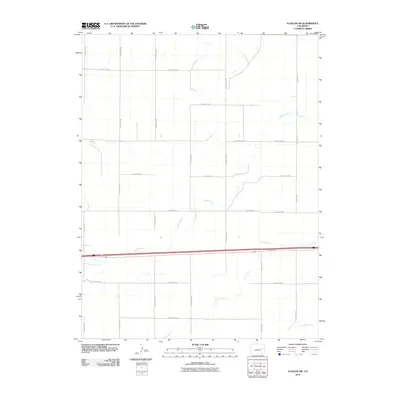
2010 Map of Flagler SW
USGS Topo · Published 2010About this map
Sevenmile Ranch and its neighboring agricultural tracts define this section of the High Plains as it appeared at the end of the 2000s. The landscape is characterized by the expansive section-line road network typical of Lincoln County, where routes like County Road X and County Road V intersect a terrain carved by seasonal drainage. The hydrology of the region is centered on the winding course of Duck Creek, which traverses the central portion of the sheet, and Mud Creek in the southeast corner. These watercourses are vital landmarks in a landscape otherwise dominated by a rigid geometric grid of ranch access roads and the corridor of the Frontage Rd. This U.S. Geological Survey data provides a clear record of land use and rural infrastructure in the early 21st century.
Find a feature on this map
24 named features on this map. Tap any name to fly to it.
Don’t see what you’re looking for? This feature index may not catch every label — zoom into the map to look around manually.
Map Details
Editions of this 2010 Flagler SW Map
This is the sole edition of this map. No revisions or reprints were ever made.
Other maps of this area

1954 · Limon
USGS Topo · 1:250,000

1957 · Limon
USGS Topo · 1:250,000

1958 · Limon
USGS Topo · 1:250,000

1978 · Hugo 4 NW
USGS Topo · 1:24,000

1979 · Sevenmile Ranch
USGS Topo · 1:24,000

1979 · Hugo 4 NE
USGS Topo · 1:24,000

1979 · Arriba
USGS Topo · 1:24,000

1979 · Flagler SW
USGS Topo · 1:24,000

1979 · Flagler NW
USGS Topo · 1:24,000

1979 · Flagler
USGS Topo · 1:24,000