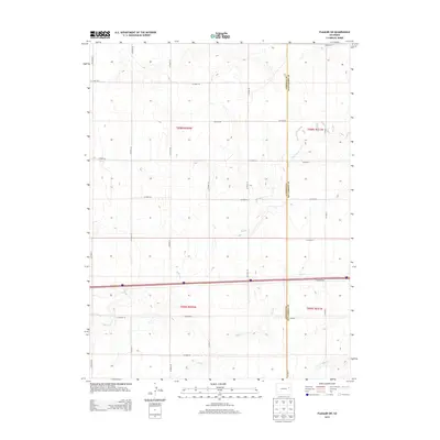
2013 Map of Flagler SW
USGS Topo · Published 2013About this map
Lincoln and Kit Carson counties meet in this high plains landscape of eastern Colorado, where a strictly geometric grid of county roads defines the human geography. The terrain is subtly etched by the seasonal drainage patterns of Buffalo Cr, Duck Cr, and Mud Cr, which break the monotony of the section-line roads. Ranching remains the primary footprint in this area, anchored by locations such as Sevenmile Ranch and Arriba Ranch. A major transportation corridor, including Frontage Rd, cuts through the southern half of the quadrangle, representing the modern path across a territory once divided by the Public Land Survey System townships of t008s r052w and t009s r051w. The map preserves the exact alignment of rural infrastructure, from Co Road AA in the north to Co Road 0 on the eastern boundary.
Find a feature on this map
36 named features on this map. Tap any name to fly to it.
Don’t see what you’re looking for? This feature index may not catch every label — zoom into the map to look around manually.
Map Details
Editions of this 2013 Flagler SW Map
This is the sole edition of this map. No revisions or reprints were ever made.
Other maps of this area

1954 · Limon
USGS Topo · 1:250,000

1957 · Limon
USGS Topo · 1:250,000

1958 · Limon
USGS Topo · 1:250,000

1978 · Hugo 4 NW
USGS Topo · 1:24,000

1979 · Sevenmile Ranch
USGS Topo · 1:24,000

1979 · Hugo 4 NE
USGS Topo · 1:24,000

1979 · Arriba
USGS Topo · 1:24,000

1979 · Flagler SW
USGS Topo · 1:24,000

1979 · Flagler NW
USGS Topo · 1:24,000

1979 · Flagler
USGS Topo · 1:24,000