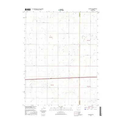
2016 Map of Flagler SW
USGS Topo · Published 2016About this map
Buffalo Cr and Duck Cr define the drainage patterns of this high plains landscape on the border of Lincoln and Kit Carson counties. This 2016 survey by the U.S. Geological Survey illustrates the strictly organized section lines and township boundaries of t9s r52w and its neighbors. The terrain is largely defined by wide, shallow draws and the intricate network of county roads, such as Co Rd 44 and Co Rd 1, that follow the cardinal directions of the Public Land Survey System. The presence of the I- 70 Frontage Rd running east-west indicates the primary modern transit corridor that bisects these rural ranchlands. To the southeast, Mud Cr enters the frame, marking one of the few distinct hydrological features in an area otherwise characterized by intermittent drainage and subtle topographical shifts.
Find a feature on this map
26 named features on this map. Tap any name to fly to it.
Don’t see what you’re looking for? This feature index may not catch every label — zoom into the map to look around manually.
Map Details
Editions of this 2016 Flagler SW Map
This is the sole edition of this map. No revisions or reprints were ever made.
Other maps of this area

1954 · Limon
USGS Topo · 1:250,000

1957 · Limon
USGS Topo · 1:250,000

1958 · Limon
USGS Topo · 1:250,000

1978 · Hugo 4 NW
USGS Topo · 1:24,000

1979 · Sevenmile Ranch
USGS Topo · 1:24,000

1979 · Hugo 4 NE
USGS Topo · 1:24,000

1979 · Arriba
USGS Topo · 1:24,000

1979 · Flagler SW
USGS Topo · 1:24,000

1979 · Flagler NW
USGS Topo · 1:24,000

1979 · Flagler
USGS Topo · 1:24,000