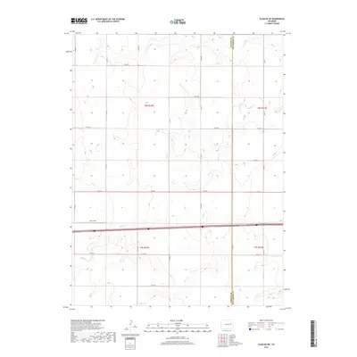
2019 Map of Flagler SW
USGS Topo · Published 2019About this map
The High Plains landscape of eastern Colorado is defined here by the intersection of traditional section-line roads and modern transit corridors. The border between Lincoln and Kit Carson counties cuts vertically through the eastern portion of the map, marking a transition between these two agricultural regions. This 2019 survey captures the area’s dependence on intermittent watercourses, with the wandering paths of Buffalo Cr, Duck Cr, and Mud Cr providing the primary relief against the grid of county roads. The southern half of the map is anchored by the east-west corridor of Interstate 70, accompanied by the I-70 Frontage Rd, which serves as the primary artery for local commerce and access to landmarks such as Koch Field. The vast township and range system remains the dominant organizational force, illustrated by the precise boundaries of t8s r52w and t9s r51w.
Find a feature on this map
28 named features on this map. Tap any name to fly to it.
Don’t see what you’re looking for? This feature index may not catch every label — zoom into the map to look around manually.
Map Details
Editions of this 2019 Flagler SW Map
This is the sole edition of this map. No revisions or reprints were ever made.
Other maps of this area

1954 · Limon
USGS Topo · 1:250,000

1957 · Limon
USGS Topo · 1:250,000

1958 · Limon
USGS Topo · 1:250,000

1978 · Hugo 4 NW
USGS Topo · 1:24,000

1979 · Sevenmile Ranch
USGS Topo · 1:24,000

1979 · Hugo 4 NE
USGS Topo · 1:24,000

1979 · Arriba
USGS Topo · 1:24,000

1979 · Flagler SW
USGS Topo · 1:24,000

1979 · Flagler NW
USGS Topo · 1:24,000

1979 · Flagler
USGS Topo · 1:24,000