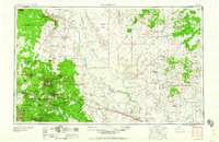
1960 Map of Flagstaff
USGS Topo · Published 1960About this map
Flagstaff and the high desert plains of the Painted Desert anchor this mid-century view of Northern Arizona. The map illustrates a complex cultural landscape where the Navajo Indian Reservation and Hopi Indian Reservation meet, showing established villages like Old Oraibi, Walpi, and Hotevilla alongside the expansion of trade at the Gray Mountain Trading Post. The region's unique geology is heavily featured, from the distinct rim of Meteor Crater to the volcanic features of Sunset Crater Natl Mon.
Find a feature on this map
106 named features on this map. Tap any name to fly to it.
Don’t see what you’re looking for? This feature index may not catch every label — zoom into the map to look around manually.
Map Details
Editions of this 1960 Flagstaff Map
2 editions found

Other maps of this area

1883 · Marsh Pass
USGS Topo · 1:250,000

1883 · Tusayan
USGS Topo · 1:250,000

1886 · St Johns
USGS Topo · 1:250,000

1886 · Tusayan
USGS Topo · 1:250,000

1886 · Fort Defiance
USGS Topo · 1:250,000

1886 · San Francisco Mtns
USGS Topo · 1:250,000

1886 · Chino
USGS Topo · 1:250,000

1886 · Echo Cliffs
USGS Topo · 1:250,000

1886 · Holbrook
USGS Topo · 1:250,000

1886 · Kaibab
USGS Topo · 1:250,000