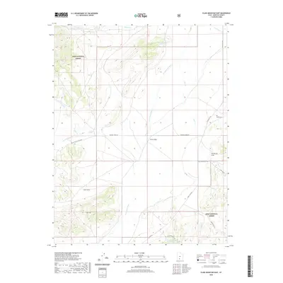
2020 Map of Flake Mountain East
USGS Topo · Published 2020About this map
Johns Valley occupies the central corridor of this Garfield County survey, bordered by the high elevations of Flake Mtn and the sprawling acreage of the Dixie National Forest. This high-altitude plateau is defined by its complex drainage systems, including the E Fork Sevier River and numerous ephemeral creeks like Clay Cr and Prospect Cr. Evidence of the area's pioneer past remains at the Widtsoe Cem, a vital point of interest for genealogists tracing families from the former settlement in the valley's northeastern reaches.
Find a feature on this map
28 named features on this map. Tap any name to fly to it.
Don’t see what you’re looking for? This feature index may not catch every label — zoom into the map to look around manually.
Map Details
Editions of this 2020 Flake Mountain East Map
This is the sole edition of this map. No revisions or reprints were ever made.
Other maps of this area

1886 · Kanab
USGS Topo · 1:250,000

1886 · Escalante
USGS Topo · 1:250,000

1953 · Cedar City
USGS Topo · 1:250,000

1956 · Escalante
USGS Topo · 1:250,000

1958 · Cedar City
USGS Topo · 1:250,000

1960 · Escalante
USGS Topo · 1:250,000

1962 · Cedar City
USGS Topo · 1:250,000
1964 · Grass Lakes
USGS Topo · 1:24,000
1964 · Sweetwater Creek
USGS Topo · 1:24,000
1964 · Pine Lake
USGS Topo · 1:24,000